
A surveyor is responsible for accurately measuring and mapping the Earth’s surface. They play a crucial role in land development, construction, and infrastructure projects by determining property boundaries, topographical features, and elevation changes. Using advanced tools like GPS, GNSS, RTK, and LiDAR, surveyors ensure that projects are completed with precision. In this guide, we will explore what a surveyor does, the different surveying methods, and the cutting-edge technologies that enhance their work.
The Essential Role of a Surveyor in Land Measurement and Mapping
Surveyors are indispensable in various industries, ensuring accurate land measurement, geospatial data collection, and mapping. Their expertise is required for:
- Construction and Infrastructure – Ensuring accurate site preparation and foundation layouts.
- Real Estate and Property Development – Defining property boundaries for legal and zoning purposes.
- Environmental and Agricultural Planning – Mapping terrains for ecological studies and resource management.
- Aerial and Drone Surveying – Capturing high-resolution geospatial data for large-scale mapping.
Surveying Methods – How a Surveyor Collects Accurate Data
Surveyors use a range of techniques and technologies to ensure precise measurements. Some of the most common surveying methods include:
| Traditional Methods | Modern Methods |
|---|---|
| Theodolite & Compass | GPS & GNSS Surveying |
| Tape Measurements | RTK & PPK Positioning |
| Manual Leveling | Aerial Photogrammetry |
| Optical Total Stations | 3D Laser Scanning (LiDAR) |
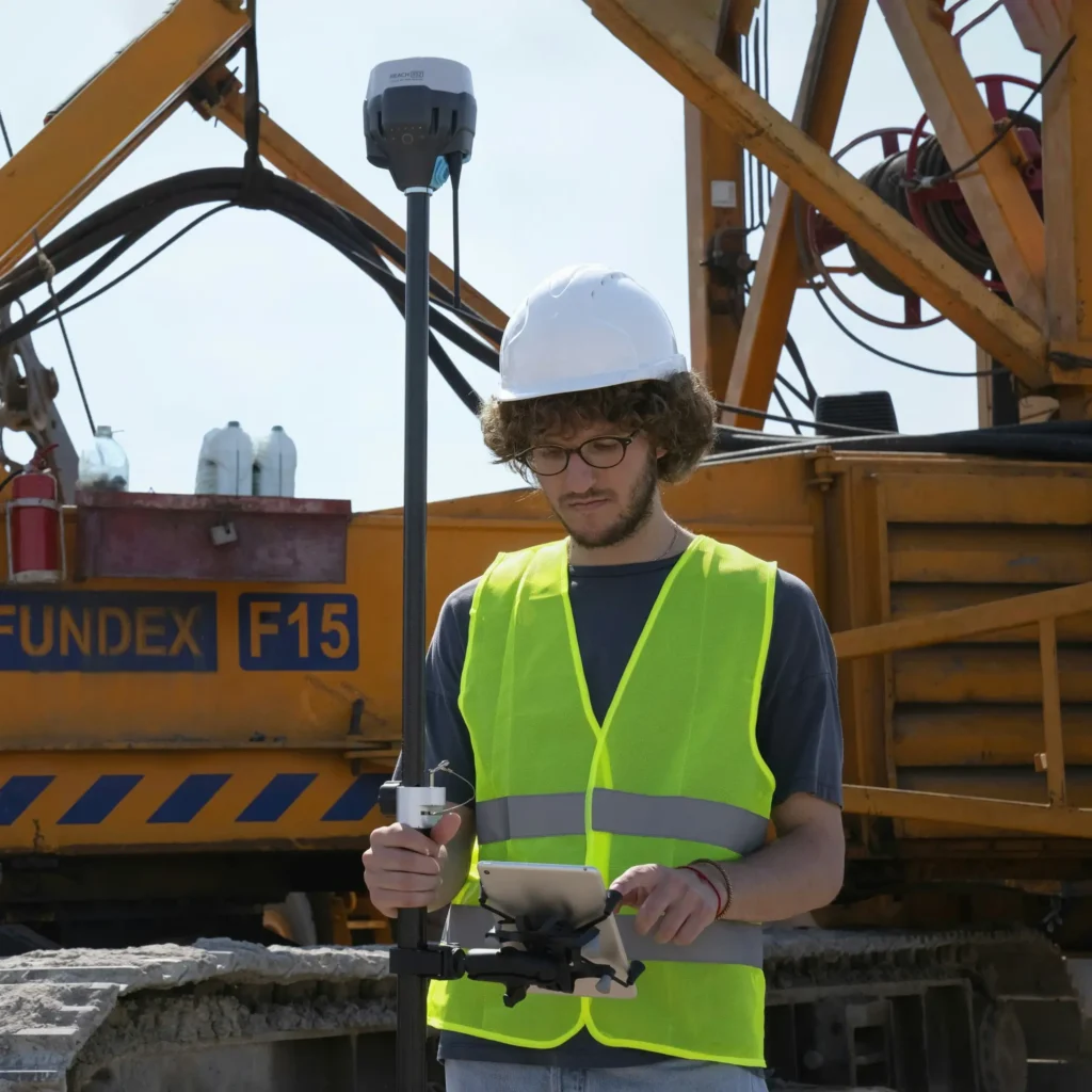
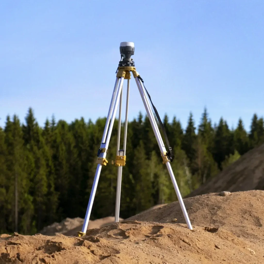
GPS and GNSS – How a Surveyor Uses Satellite-Based Positioning
Modern surveyors rely on Global Positioning System (GPS) and Global Navigation Satellite Systems (GNSS) to pinpoint locations with high accuracy. These technologies provide real-time geospatial data essential for large-scale projects.
RTK and PPK – Enhancing Surveyor Accuracy in Geospatial Mapping
- RTK (Real-Time Kinematic) delivers instant corrections for highly precise positioning.
- PPK (Post-Processed Kinematic) refines data after collection, ensuring surveyors achieve sub-centimeter accuracy.
Photogrammetry – A Surveyor’s Tool for 3D Terrain Mapping
Using drones and specialized cameras, surveyors create 3D terrain models by analyzing multiple overlapping images. This technique is essential for topographical studies and infrastructure development.
LiDAR – How a Surveyor Uses Laser Scanning for High-Resolution Mapping
LiDAR (Light Detection and Ranging) allows surveyors to capture detailed 3D models of landscapes and structures. This method is widely used in aerial surveying, forestry, and urban planning.
The Role of a Surveyor in Construction and Infrastructure Development
Surveyors are crucial in the construction industry, ensuring accuracy in:
- Building Layouts – Marking foundation lines and elevation points.
- Road and Bridge Construction – Mapping terrain changes for safe structural designs.
- Utility and Pipeline Mapping – Preventing infrastructure conflicts and optimizing resource placement.
Choosing a Professional Surveyor for Your Project
When hiring a surveyor, consider:
- Certifications and Experience – Ensure they meet industry standards.
- Technological Expertise – Knowledge of GPS, GNSS, LiDAR, and photogrammetry is a plus.
- Industry Specialization – Find a surveyor experienced in your specific project type.
Share Your Surveying Data with SurveyTransfer!
Once a surveyor collects and processes data, sharing it efficiently is key. SurveyTransfer allows professionals to upload, store, and share high-resolution geospatial data effortlessly. Whether working with LiDAR point clouds, 3D models, or aerial maps, SurveyTransfer ensures seamless collaboration.

Summary – The Surveyor’s Impact on Geospatial Data Collection
A surveyor is essential in land measurement, mapping, and construction projects. By utilizing advanced methods like GPS, GNSS, RTK, PPK, LiDAR, and photogrammetry, they ensure accuracy and efficiency. Whether defining property boundaries or planning large-scale developments, surveyors play a critical role in geospatial data collection and analysis.
Need to share your surveyor data easily? Try SurveyTransfer today!
If you really liked what you read than you can share it with your friends. 🙂
Did you like what you read? Do you want to read similar ones?