SurveyTransfer SurveyTransfer SurveyTransfer SurveyTransfer
  • Get Started
  • Blog
    • English
    • Hungarian
  • Pricing
  • Contact Us
  • Newsletter
  • Free Version Release Date
SurveyTransfer
point cloud; polyline; vektorize; pontfelhő; vonal; vektorizálás
  • By: SurveyTransfer Team
  • 2023-05-29

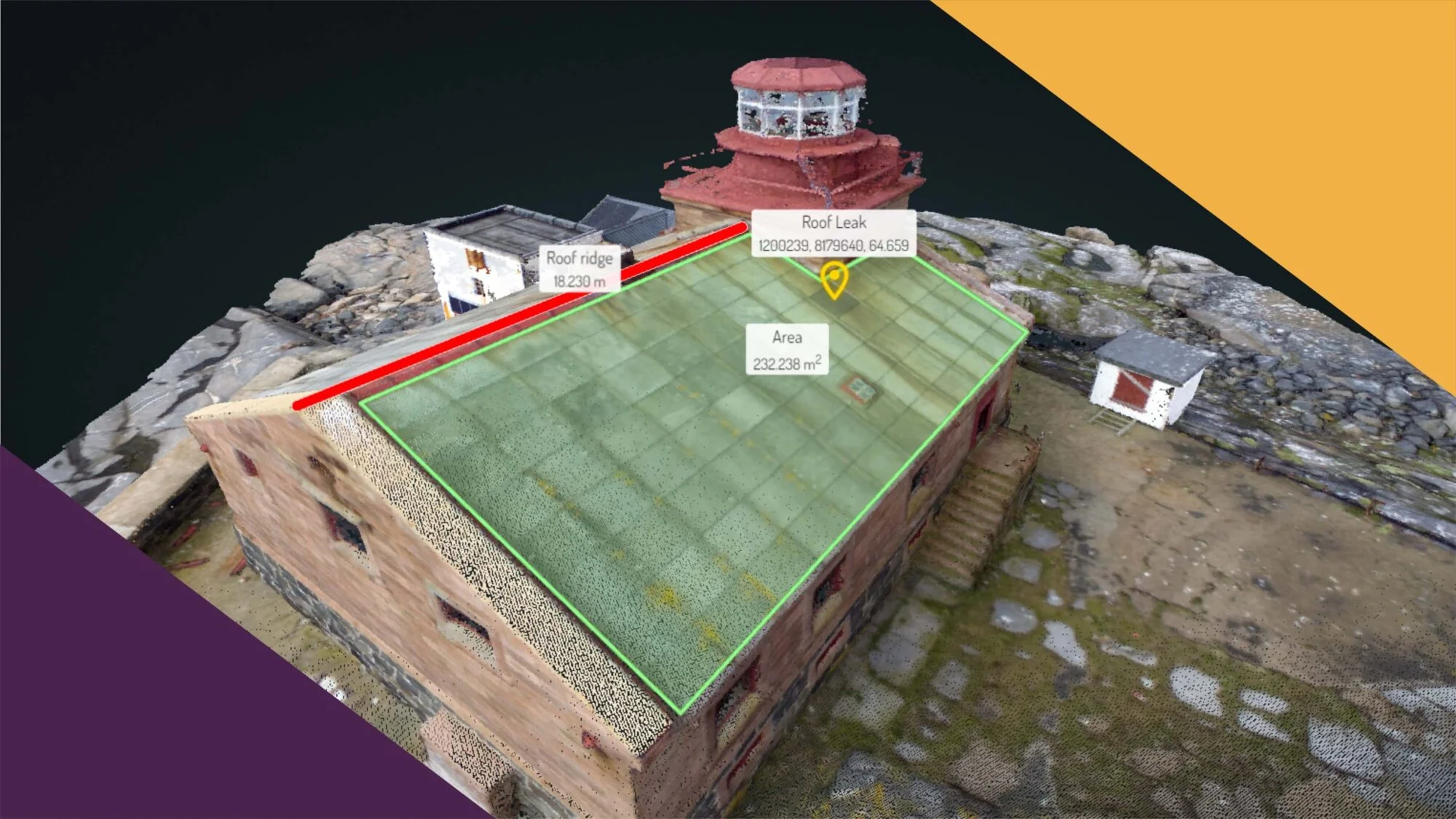
A guide to polyline-based vectorization of a point cloud

A guide to polyline-based vectorization of a point cloud https://i0.wp.com/surveytransfer.net/wp-content/uploads/2023/05/cover_img_point-cloud_pontfelho_polyline_vonal_vektorize_vektorizalas_169-scaled.jpg?fit=1024%2C576&ssl=1 1024 576 SurveyTransfer SurveyTransfer //surveytransfer.net/wp-content/uploads/2021/11/dc_logo_V7_transparent.png 2023-05-29 2023-05-28

Step-by-step presentation of point cloud-based polyline vectorization, as well as the possibility of sharing the polyline on the web.

point cloud; polyline; vektorize; pontfelhő; vonal; vektorizálás
  • By: SurveyTransfer Team
  • 2023-05-29

Útmutató egy pontfelhő vonallánc alapú vektorizálásához

Útmutató egy pontfelhő vonallánc alapú vektorizálásához https://i0.wp.com/surveytransfer.net/wp-content/uploads/2023/05/cover_img_point-cloud_pontfelho_polyline_vonal_vektorize_vektorizalas_169-scaled.jpg?fit=1024%2C576&ssl=1 1024 576 SurveyTransfer SurveyTransfer //surveytransfer.net/wp-content/uploads/2021/11/dc_logo_V7_transparent.png 2023-05-29 2023-05-29

Pontfelhő alapú vonallánc vektorizálás bemutatása lépésről lépésre, valamint egy újdonság a vonallánc webes adatmosztási lehetőségéről.

drone surveying, industrial surveying, surveying, drón felmérés, ipari felmérés, felmérés
  • By: SurveyTransfer Team
  • 2023-05-08

The Future of Surveying: How Drones are Revolutionizing the Industry

The Future of Surveying: How Drones are Revolutionizing the Industry https://i0.wp.com/surveytransfer.net/wp-content/uploads/2023/05/cover_img_26_169.jpg?fit=1024%2C576&ssl=1 1024 576 SurveyTransfer SurveyTransfer //surveytransfer.net/wp-content/uploads/2021/11/dc_logo_V7_transparent.png 2023-05-08 2023-05-07

We asked ChatGPT about the role of drone surveying, industrial drones and drone technology in surveys in general.

drone surveying, industrial surveying, surveying, drón felmérés, ipari felmérés, felmérés
  • By: SurveyTransfer Team
  • 2023-05-08

A felmérések jövője: Hogyan forradalmasítják az iparágat a drónok

A felmérések jövője: Hogyan forradalmasítják az iparágat a drónok https://i0.wp.com/surveytransfer.net/wp-content/uploads/2023/05/cover_img_26_169.jpg?fit=1024%2C576&ssl=1 1024 576 SurveyTransfer SurveyTransfer //surveytransfer.net/wp-content/uploads/2021/11/dc_logo_V7_transparent.png 2023-05-08 2023-05-08

A drónos felmérés, ipari drónozás és általánosságban a drón technológia felmérésekben betöltött szerepéről kérdeztük a ChatGPT-t.

drone-surveying-business-sales-drón-felmérés-üzlet-értékesítés-vállalkozás
  • By: SurveyTransfer Team
  • 2023-04-17

10 Észbontóan jó tanács drónos felmérő vállalkozás beindításához

10 Észbontóan jó tanács drónos felmérő vállalkozás beindításához https://i0.wp.com/surveytransfer.net/wp-content/uploads/2023/04/cover_img_25_169-scaled.jpg?fit=1024%2C576&ssl=1 1024 576 SurveyTransfer SurveyTransfer //surveytransfer.net/wp-content/uploads/2021/11/dc_logo_V7_transparent.png 2023-04-17 2023-04-17

Tudd meg, hogy milyen üzleti megfontolások szükségesek egy drónos felmérésekkel foglalkozó vállalkozás beindításához.

drone-surveying-business-sales-drón-felmérés-üzlet-értékesítés-vállalkozás
  • By: SurveyTransfer Team
  • 2023-04-17

10 Mind-Blowing Tips for Starting Your Drone Surveying Business

10 Mind-Blowing Tips for Starting Your Drone Surveying Business https://i0.wp.com/surveytransfer.net/wp-content/uploads/2023/04/cover_img_25_169-scaled.jpg?fit=1024%2C576&ssl=1 1024 576 SurveyTransfer SurveyTransfer //surveytransfer.net/wp-content/uploads/2021/11/dc_logo_V7_transparent.png 2023-04-17 2023-05-17

Learn the business considerations for starting a drone survey business (e.g. sales strategy, marketing, customer experience, business model)

Blender; 3D; 3D model; 3D model
  • By: SurveyTransfer Team
  • 2023-03-27

3D Model & Blender – Solid creation and calculation options

3D Model & Blender – Solid creation and calculation options https://i0.wp.com/surveytransfer.net/wp-content/uploads/2023/03/cover_img_24_169.jpg?fit=1024%2C576&ssl=1 1024 576 SurveyTransfer SurveyTransfer //surveytransfer.net/wp-content/uploads/2021/11/dc_logo_V7_transparent.png 2023-03-27 2023-03-24

Geoinformatics solid 3D model creation, volume and surface calculation and FEM 3D model export can be done in Blender.

Blender; 3D; 3D model; 3D model
  • By: SurveyTransfer Team
  • 2023-03-27

3D Modell & Blender – szilárdtest készítése és számítási lehetőségek

3D Modell & Blender – szilárdtest készítése és számítási lehetőségek https://i0.wp.com/surveytransfer.net/wp-content/uploads/2023/03/cover_img_24_169.jpg?fit=1024%2C576&ssl=1 1024 576 SurveyTransfer SurveyTransfer //surveytransfer.net/wp-content/uploads/2021/11/dc_logo_V7_transparent.png 2023-03-27 2023-03-24

Blenderben elvégezhető geoinformatikai célú solid 3D modell készítés, térfogatszámítás, felszínszámítás és FEM 3D modell exportálás.

CloudCompare; Point cloud; pontfelhő
  • By: SurveyTransfer Team
  • 2023-03-06

CloudCompare & Pontfelhő – 3 kihagyhatatlan pontfelhő elemzés

CloudCompare & Pontfelhő – 3 kihagyhatatlan pontfelhő elemzés https://i0.wp.com/surveytransfer.net/wp-content/uploads/2023/03/cover_img_23_169_origin-scaled.jpg?fit=1024%2C576&ssl=1 1024 576 SurveyTransfer SurveyTransfer //surveytransfer.net/wp-content/uploads/2021/11/dc_logo_V7_transparent.png 2023-03-06 2023-03-05

CloudComapre szoftverben elvégezhető kihagyhatatlan potnfelhő elemzések: CSF, Pontfelhő tisztítás mesh generálással és raszteres konverzió.

CloudCompare; Point cloud; pontfelhő
  • By: SurveyTransfer Team
  • 2023-03-06

CloudCompare & Point Cloud – 3 must-have point cloud analyses

CloudCompare & Point Cloud – 3 must-have point cloud analyses https://i0.wp.com/surveytransfer.net/wp-content/uploads/2023/03/cover_img_23_169_origin-scaled.jpg?fit=1024%2C576&ssl=1 1024 576 SurveyTransfer SurveyTransfer //surveytransfer.net/wp-content/uploads/2021/11/dc_logo_V7_transparent.png 2023-03-06 2023-03-05

Unmissable point cloud analyzes with CloudComapre software: CSF, Point cloud cleaning with mesh generation and raster conversion.

open drone map; map; 3D model; drone; térkép; 3D modell
  • By: SurveyTransfer Team
  • 2023-02-13

Open Drone Map – hozd ki a legtöbbet a térképből és 3D modellből!

Open Drone Map – hozd ki a legtöbbet a térképből és 3D modellből! https://i0.wp.com/surveytransfer.net/wp-content/uploads/2023/02/cover_img_22_169-scaled.jpg?fit=1024%2C576&ssl=1 1024 576 SurveyTransfer SurveyTransfer //surveytransfer.net/wp-content/uploads/2021/11/dc_logo_V7_transparent.png 2023-02-13 2023-02-13

Az Open Drone Map részletes beállításaiból megtudhatod, hogy milyen paraméterekkel lehet a legszebb térképeket és 3D modelleket létrehozni.

open drone map; map; 3D model; drone; térkép; 3D modell
  • By: SurveyTransfer Team
  • 2023-02-13

Open Drone Map – Get the most out of map and 3D model

Open Drone Map – Get the most out of map and 3D model https://i0.wp.com/surveytransfer.net/wp-content/uploads/2023/02/cover_img_22_169-scaled.jpg?fit=1024%2C576&ssl=1 1024 576 SurveyTransfer SurveyTransfer //surveytransfer.net/wp-content/uploads/2021/11/dc_logo_V7_transparent.png 2023-02-13 2023-02-13

From the detailed settings of Open Drone Map, you can find out which parameters can be used to create the most beautiful maps and 3D models.

légi-térképészet-aerial-map
  • By: SurveyTransfer Team
  • 2023-01-23

Egy AI gondolatai a légi térképészet jelenéről és jövőjéről

Egy AI gondolatai a légi térképészet jelenéről és jövőjéről https://i0.wp.com/surveytransfer.net/wp-content/uploads/2023/01/cover_img_21_169-scaled.jpg?fit=1024%2C576&ssl=1 1024 576 SurveyTransfer SurveyTransfer //surveytransfer.net/wp-content/uploads/2021/11/dc_logo_V7_transparent.png 2023-01-23 2023-01-23

Egy AI segítségét kértük, hogy egy cikket írjon a légi térképészet fejlődéséről, jelenéről és várható jövőbeli trendjéről.

légi-térképészet-aerial-map
  • By: SurveyTransfer Team
  • 2023-01-23

An AI’s thoughts on the Current State and future of aerial mapping

An AI’s thoughts on the Current State and future of aerial mapping https://i0.wp.com/surveytransfer.net/wp-content/uploads/2023/01/cover_img_21_169-scaled.jpg?fit=1024%2C576&ssl=1 1024 576 SurveyTransfer SurveyTransfer //surveytransfer.net/wp-content/uploads/2021/11/dc_logo_V7_transparent.png 2023-01-23 2023-01-23

We asked for the help of an AI to write an article about the development, present and expected future trends of aerial mapping.

photogrammetry;fotogrammetria;3D;project;projekt
  • By: SurveyTransfer Team
  • 2023-01-02

5 great strategies to close a 3D photogrammetry project ahead of schedule

5 great strategies to close a 3D photogrammetry project ahead of schedule https://i0.wp.com/surveytransfer.net/wp-content/uploads/2022/12/cover_img_20_169-1-scaled.jpg?fit=1024%2C576&ssl=1 1024 576 SurveyTransfer SurveyTransfer //surveytransfer.net/wp-content/uploads/2021/11/dc_logo_V7_transparent.png 2023-01-02 2023-03-23

With the right strategy, you can increase the number of 3D photogrammetry projects that can be completed in a year, the key to this is meeting short deadlines.

photogrammetry;fotogrammetria;3D;project;projekt
  • By: SurveyTransfer Team
  • 2023-01-02

5 nagyszerű stratégia egy 3D fotogrammetriai projekt korai lezárásához

5 nagyszerű stratégia egy 3D fotogrammetriai projekt korai lezárásához https://i0.wp.com/surveytransfer.net/wp-content/uploads/2022/12/cover_img_20_169-1-scaled.jpg?fit=1024%2C576&ssl=1 1024 576 SurveyTransfer SurveyTransfer //surveytransfer.net/wp-content/uploads/2021/11/dc_logo_V7_transparent.png 2023-01-02 2022-12-30

Megfelelő stratégiával jelentősen növelheted az adott évben elvégezhető 3D fotogrammetriai projektek számát.

SurveyTransfer-adatmegoszto-data sharing
  • By: SurveyTransfer Team
  • 2022-12-12

SurveyTransfer 2023. évtervező – Az új adatmegosztó úton van!

SurveyTransfer 2023. évtervező – Az új adatmegosztó úton van! https://i0.wp.com/surveytransfer.net/wp-content/uploads/2022/12/cover_img_19_169-scaled.jpg?fit=1024%2C576&ssl=1 1024 576 SurveyTransfer SurveyTransfer //surveytransfer.net/wp-content/uploads/2021/11/dc_logo_V7_transparent.png 2022-12-12 2022-12-11

A SurveyTransfer 2023-as évtervezőjében betekinthetsz a következő éves terveinkbe és az előttünk álló mérföldkövekbe.

SurveyTransfer-adatmegoszto-data sharing
  • By: SurveyTransfer Team
  • 2022-12-12

SurveyTransfer 2023 Year Planner – The new data sharing platform is on the way!

SurveyTransfer 2023 Year Planner – The new data sharing platform is on the way! https://i0.wp.com/surveytransfer.net/wp-content/uploads/2022/12/cover_img_19_169-scaled.jpg?fit=1024%2C576&ssl=1 1024 576 SurveyTransfer SurveyTransfer //surveytransfer.net/wp-content/uploads/2021/11/dc_logo_V7_transparent.png 2022-12-12 2022-12-11

In SurveyTransfer’s 2023 year planner, you can take a look at our plans for the next year and the milestones ahead.

drón; kép; térkép; 3D; drone; image; map
  • By: SurveyTransfer Team
  • 2022-11-21

Gyorstalpaló – Térképek és 3D modellek drónos képekből

Gyorstalpaló – Térképek és 3D modellek drónos képekből https://i0.wp.com/surveytransfer.net/wp-content/uploads/2022/11/cover_img_18_169-scaled.jpg?fit=1024%2C576&ssl=1 1024 576 SurveyTransfer SurveyTransfer //surveytransfer.net/wp-content/uploads/2021/11/dc_logo_V7_transparent.png 2022-11-21 2023-02-05

Drónos légi képekből generálható térképek és 3D modellek bemutatása nyílt forráskódú szoftver segítségével.

drón; kép; térkép; 3D; drone; image; map
  • By: SurveyTransfer Team
  • 2022-11-21

Quick Start – Maps and 3D models from drone images

Quick Start – Maps and 3D models from drone images https://i0.wp.com/surveytransfer.net/wp-content/uploads/2022/11/cover_img_18_169-scaled.jpg?fit=1024%2C576&ssl=1 1024 576 SurveyTransfer SurveyTransfer //surveytransfer.net/wp-content/uploads/2021/11/dc_logo_V7_transparent.png 2022-11-21 2023-02-05

Presentation of maps and 3D models that can be generated from drone aerial images using open source software.

fotogrammetria-légi-felmérés-photogrammetry-aerial-survey
  • By: SurveyTransfer Team
  • 2022-10-31

Szemléletmód a sikeres légi fotogrammetriai felmérési projektekhez

Szemléletmód a sikeres légi fotogrammetriai felmérési projektekhez https://i0.wp.com/surveytransfer.net/wp-content/uploads/2022/10/cover_img_17_169-scaled.jpg?fit=1024%2C576&ssl=1 1024 576 SurveyTransfer SurveyTransfer //surveytransfer.net/wp-content/uploads/2021/11/dc_logo_V7_transparent.png 2022-10-31 2022-10-31

A légi fotogrammetriai felméréshez szükséges szemléletmód bemutatása az adatgyűjtésen, feldolgozáson, ábrázoláson és megosztáson keresztül.

fotogrammetria-légi-felmérés-photogrammetry-aerial-survey
  • By: SurveyTransfer Team
  • 2022-10-31

A mindset for successful aerial photogrammetry survey projects

A mindset for successful aerial photogrammetry survey projects https://i0.wp.com/surveytransfer.net/wp-content/uploads/2022/10/cover_img_17_169-scaled.jpg?fit=1024%2C576&ssl=1 1024 576 SurveyTransfer SurveyTransfer //surveytransfer.net/wp-content/uploads/2021/11/dc_logo_V7_transparent.png 2022-10-31 2022-10-29

Presentation of the required mindset for aerial photogrammetry survey through data collection, processing, visualization and data sharing.

stereo-sztereo-3D-geospatial-térinformatika
  • By: József Borján
  • 2022-10-10

Similarity of Stereo Technique and Geospatial Procedures

Similarity of Stereo Technique and Geospatial Procedures https://i0.wp.com/surveytransfer.net/wp-content/uploads/2022/10/cover_img_16_169-scaled.jpg?fit=1024%2C576&ssl=1 1024 576 SurveyTransfer SurveyTransfer //surveytransfer.net/wp-content/uploads/2021/11/dc_logo_V7_transparent.png 2022-10-10 2022-10-08

3D stereo visualization is a useful tool for sketches, figures, animations, photos and videos. It is similar to geospatial procedures.

stereo-sztereo-3D-geospatial-térinformatika
  • By: Borján József
  • 2022-10-10

A sztereo technikai és a térinformatikai eljárások hasonlósága

A sztereo technikai és a térinformatikai eljárások hasonlósága https://i0.wp.com/surveytransfer.net/wp-content/uploads/2022/10/cover_img_16_169-scaled.jpg?fit=1024%2C576&ssl=1 1024 576 SurveyTransfer SurveyTransfer //surveytransfer.net/wp-content/uploads/2021/11/dc_logo_V7_transparent.png 2022-10-10 2022-10-08

A 3D-s sztereo megjelenítés – a térinformatikához hasonlóan – a vázlatok, ábrák, animációk, fotók és videók esetében is hasznos eszköz.

geoinformatics-térinformatika
  • By: SurveyTransfer Team
  • 2022-09-19

A térinformatikáról röviden

A térinformatikáról röviden https://i0.wp.com/surveytransfer.net/wp-content/uploads/2021/11/cover_img_01_169-1-scaled.jpg?fit=1024%2C576&ssl=1 1024 576 SurveyTransfer SurveyTransfer //surveytransfer.net/wp-content/uploads/2021/11/dc_logo_V7_transparent.png 2022-09-19 2022-10-03

A térinformatika alapja az adatgyűjtés, feldolgozás, tárolás, megjelenítés. A négy egység mentén foglaljuk össze a térinformatika lényegét.

geoinformatics-térinformatika
  • By: SurveyTransfer Team
  • 2022-09-19

About geoinformatics in a nutshell

About geoinformatics in a nutshell https://i0.wp.com/surveytransfer.net/wp-content/uploads/2021/11/cover_img_01_169-1-scaled.jpg?fit=1024%2C576&ssl=1 1024 576 SurveyTransfer SurveyTransfer //surveytransfer.net/wp-content/uploads/2021/11/dc_logo_V7_transparent.png 2022-09-19 2022-10-03

Geospatial is based on data collection, processing, storage and display. We summarize the essence of geoinformatics based on these 4 units.

drone-drón-photogrammetry-fotogrammetria
  • By: SurveyTransfer Team
  • 2022-08-29

Quick start – 3 steps to a drone photogrammetry flight plan

Quick start – 3 steps to a drone photogrammetry flight plan https://i0.wp.com/surveytransfer.net/wp-content/uploads/2022/08/cover_img_15_169-scaled.jpg?fit=1024%2C576&ssl=1 1024 576 SurveyTransfer SurveyTransfer //surveytransfer.net/wp-content/uploads/2021/11/dc_logo_V7_transparent.png 2022-08-29 2022-09-10

Presentation of aerial photogrammetry basics, drone route planning software (with mission types) and drone flight planning.

drone-drón-photogrammetry-fotogrammetria
  • By: SurveyTransfer Team
  • 2022-08-29

Gyorstalpaló – 3 lépés drónos fotogrammetriai repülési tervhez

Gyorstalpaló – 3 lépés drónos fotogrammetriai repülési tervhez https://i0.wp.com/surveytransfer.net/wp-content/uploads/2022/08/cover_img_15_169-scaled.jpg?fit=1024%2C576&ssl=1 1024 576 SurveyTransfer SurveyTransfer //surveytransfer.net/wp-content/uploads/2021/11/dc_logo_V7_transparent.png 2022-08-29 2022-09-10

Légi fotogrammetriai alapok, drón útvonaltervezést segítő szoftverek és drón repülési terv előállításának bemutatása.

  • 1
  • 2

CONTACT

  • SurveyTransfer Team
  • [email protected]

FOLLOW US

  • Facebook
  • Instagram
  • LinkedIn

Recent News

Read our latest article: English blog; Hungarian blog

If you would like to receive regular news, click here!

BEYOND DATA SHARING

Privacy Policy | Cookie Policy
Manage cookie preferences |
Early Access Game Policy | Feedback

  • Get Started
  • Blog
    • English
    • Hungarian
  • Pricing
  • Contact Us
  • Newsletter
  • Free Version Release Date
    SurveyTransfer
    Manage Cookie Consent
    To provide the best experiences, we use technologies like cookies to store and/or access device information. Consenting to these technologies will allow us to process data such as browsing behavior or unique IDs on this site. Not consenting or withdrawing consent, may adversely affect certain features and functions.
    Functional Always active
    The technical storage or access is strictly necessary for the legitimate purpose of enabling the use of a specific service explicitly requested by the subscriber or user, or for the sole purpose of carrying out the transmission of a communication over an electronic communications network.
    Preferences
    The technical storage or access is necessary for the legitimate purpose of storing preferences that are not requested by the subscriber or user.
    Statistics
    The technical storage or access that is used exclusively for statistical purposes. The technical storage or access that is used exclusively for anonymous statistical purposes. Without a subpoena, voluntary compliance on the part of your Internet Service Provider, or additional records from a third party, information stored or retrieved for this purpose alone cannot usually be used to identify you.
    Marketing
    The technical storage or access is required to create user profiles to send advertising, or to track the user on a website or across several websites for similar marketing purposes.

    Manage options Manage services Manage vendors Read more about these purposes
    View preferences
    {title} {title} {title}

    SHOW ME THE FUTURE

    ×

    Are You Interested in the Future of Maps, 3D Models and Spatial Data Sharing?

    SHOW ME THE FUTURE

    ×