
What is SurveyTransfer?
SurveyTransfer is an innovative cloud-based data sharing tool (similar to Google Drive) and a data visualization tool (with built-in map and 3D model space).
It is primarily recommended for surveying contractors who work with large maps and 3D files (e.g., photogrammetry, LiDAR results) and have difficulty transferring files to their clients.
SurveyTransfer is also useful for those who are looking for a cloud-based data storage solution where they can immediately view their maps and 3D files without having to download them.
The following video shows how the SurveyTransfer geospatial data sharing system works:
The problem identified by the SurveyTransfer team
The creators of SurveyTransfer, based on their own experience and feedback from other surveyors, noticed that sharing maps and 3D files with clients can be very difficult (read more about it here). Why is sharing spatial data so problematic?
- The client must download/copy the files, which can be time-consuming.
- After obtaining the results, the client may have to use multiple software simultaneously to open maps and 3D files.
- Not all clients have a background in GIS (Geographic Information System), and they may not want to install additional software or use complicated programs just to view the results.
- LiDAR or photogrammetric survey results are large, high-resolution files that may require powerful hardware to open and view them.
- The surveying contractor must present the results and establish an effective communication channel with the client. On average, client response times are slow, which can delay a project for one or two weeks.
The purpose of SurveyTransfer
SurveyTransfer aims to provide an effective and comprehensive solution to the problems outlined above:
- SurveyTranfer’s automatic processing module allows uploaded files (maps and 3D files) to be displayed on the web. Thanks to the web view, there is no need to wait for files to be downloaded.
- There is no need to install additional software, as SurveyTransfer can display files on map and in 3D.
- SurveyTransfer was developed in collaboration with multiple surveying companies and their partners to make the interface user-friendly for those unfamiliar with GIS or other geospatial software.
- SurveyTransfer can be opened with a web browser, so it does not require a high-performance computer; high-resolution maps or 3D files can be viewed even on a mobile phone.
- SurveyTransfer functions as a collaborative platform, as the surveying contractor and their client can both view and work on the same shared map and/or 3D view within a project. The surveying contractor and their client (if registered to SurveyTransfer) can leave annotations and messages on the map or 3D models for each other.
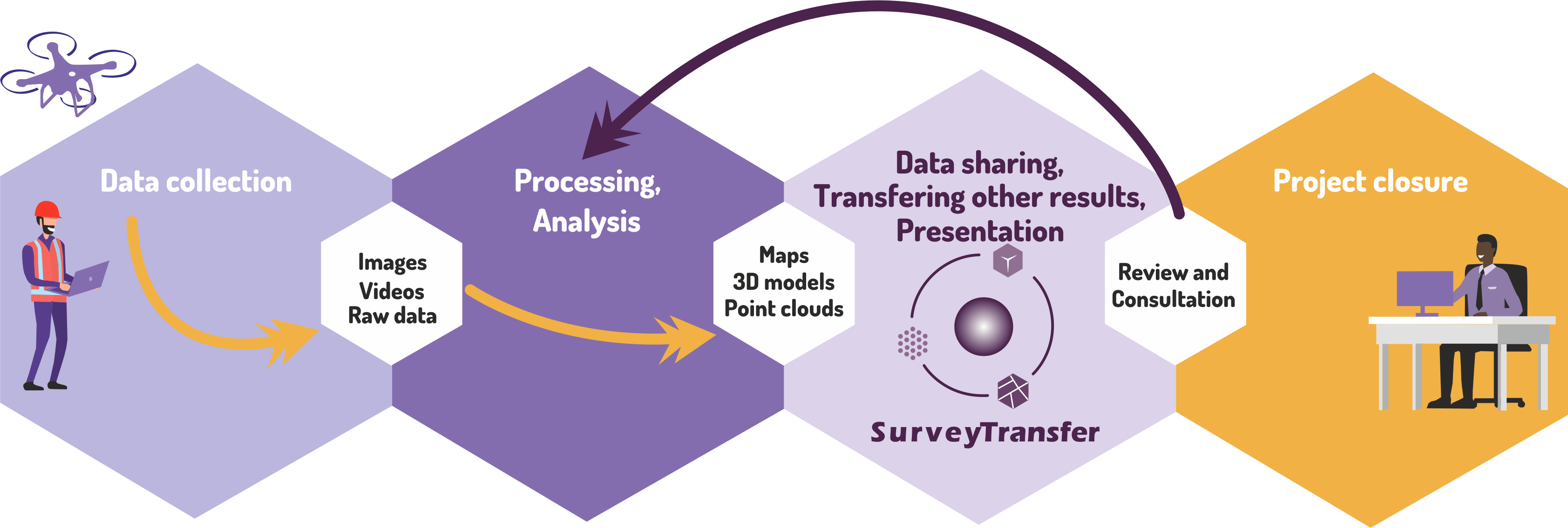
SurveyTransfer as a project management tool
In a surveying project, SurveyTransfer is an extremely useful tool for sharing results, presenting them, and receiving review and feedback. Due to the effective collaboration platform (messages/annotations on maps and in 3D) between the surveying contractor and the client, the closure of a project can be brought forward by weeks (for more details, see this blog post). Thanks to this, the surveying contractor can benefit directly from SurveyTransfer, as they can undertake/close more projects in the same amount of time, leading to increased revenue.
If you have any questions, feel free to contact us, as SurveyTransfer was created for the surveying community, and we develop the software based on user feedback and actual market needs.