
Sharing geospatial data within a business or between organizations is a well-known challenge. The difficult and time-consuming transfer of large-scale geospatial data (such as orthomosaics, point clouds, 3D models) to clients slows down the progress of projects. In this article, we reveal a simple way to share geospatial data.
During geospatial data sharing, it is not enough to just deliver the data, since the essence of the field of geospatial is data visualization. Considering all this, a new generational web-based solution must be chosen for the sharing and visualization of large data. We already wrote about this before. It also matters whether you intend the data for a wide audience or for a private customer or business partner. In the latter case, secure links and secure data access are essential.
Do you have geospatial data to share? Does the process of accessing data, visualizing it, and collaborating with partners seem to be more challenging than you thought? SurveyTransfer offers a solution with which you can turn geospatial data into beautiful online maps and 3D scenes within a few minutes. In our current article, we provide an insight into the operation of SurveyTransfer, which is not yet publicly accessible.
With the help of SurveyTransfer, you can focus on the production of geospatial data, while we ensure that it reaches business partners simply, yet safely!
1. Joining the future of geospatial data sharing
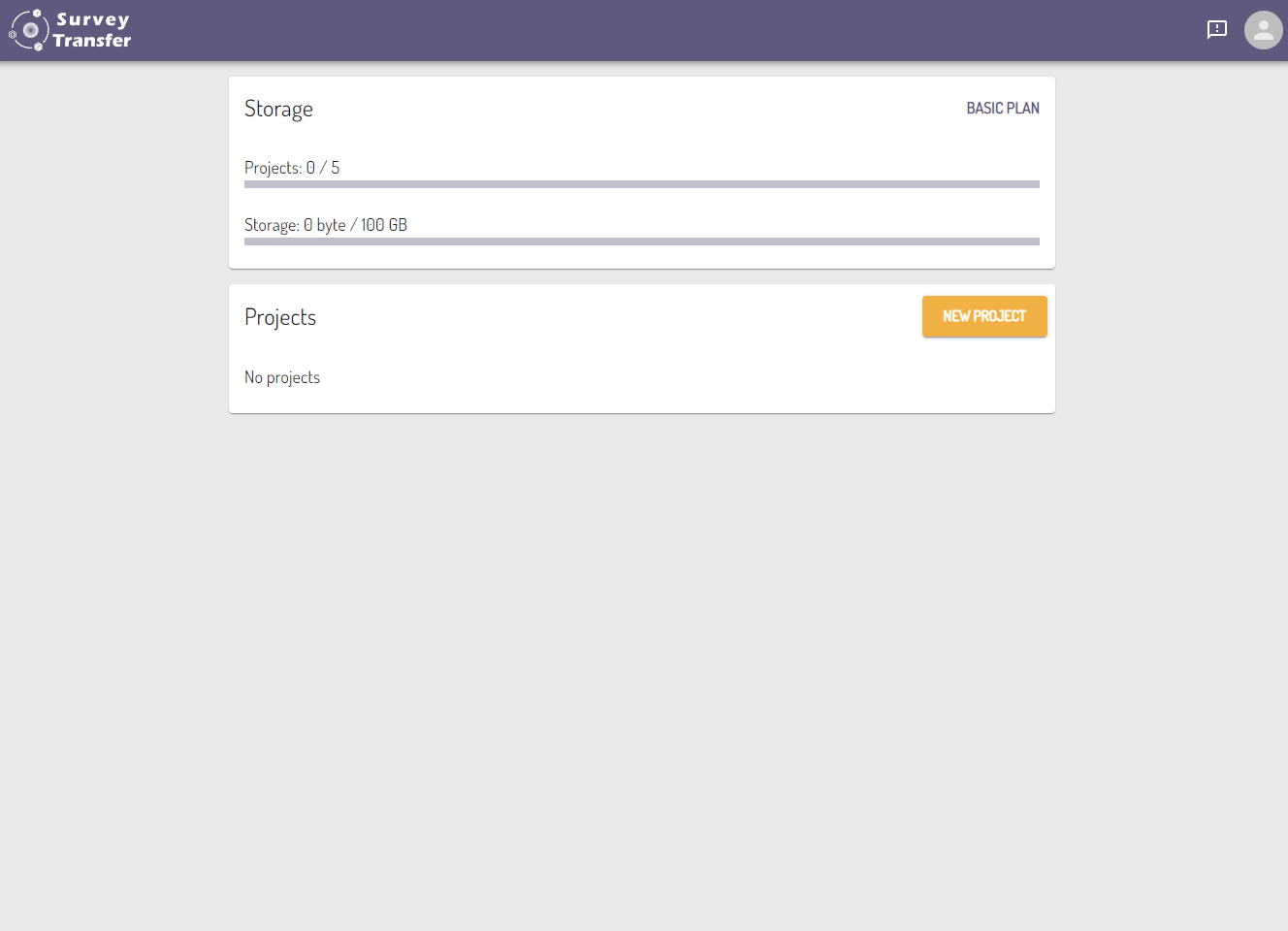
250 GB of storage space will be available to everyone by registering in the SurveyTransfer geospatial data sharing software. The size of the storage can of course be increased. By creating a new project, you can start uploading the data and then sharing it.
2. Uploading and handling geospatial FILES
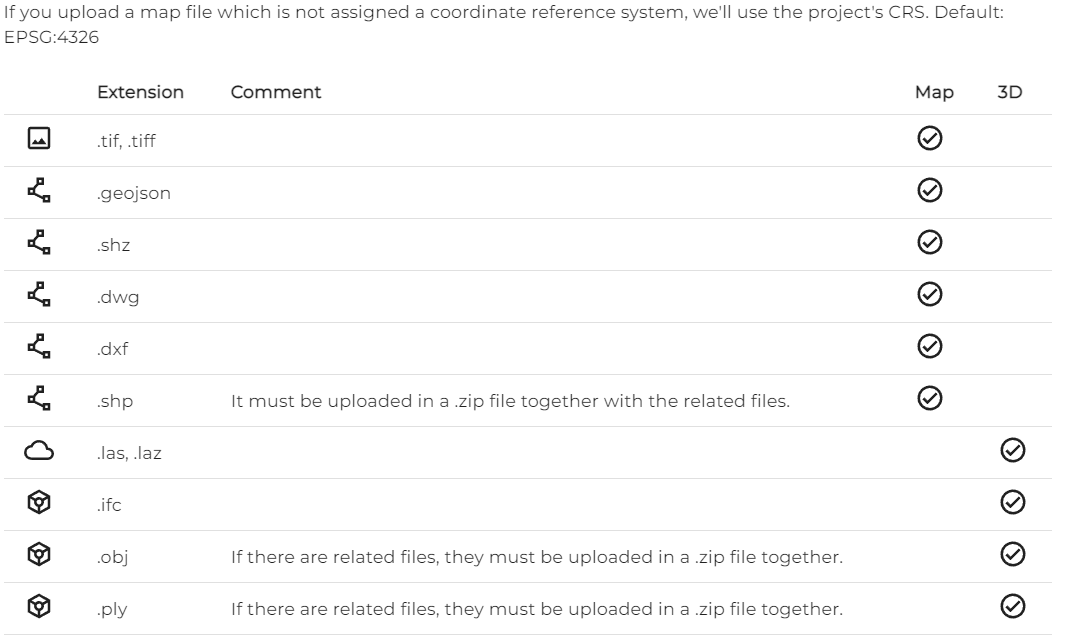
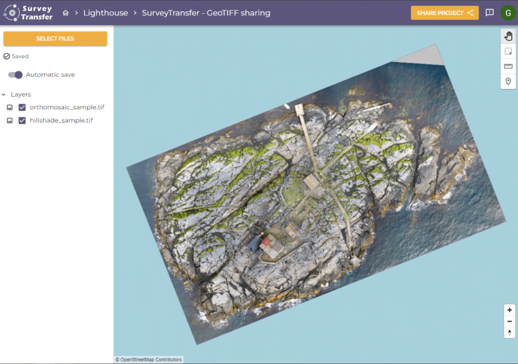
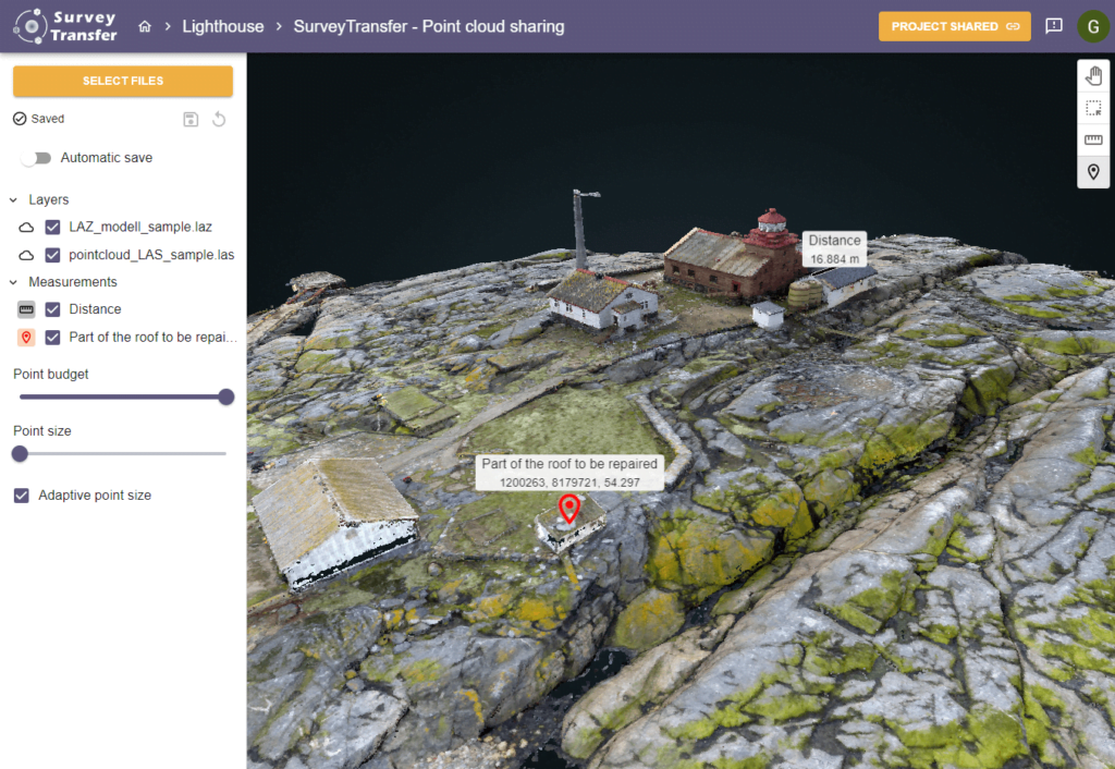
With SurveyTransfer, any extension of files can be shared, but map and 3D visualization is only available for geospatial formats. This means that any format, including image, video, text file, etc. can be uploaded, but only files that have geometric content can be represented on a map or in 3D.
We are constantly expanding the list of geospatial file formats supported by SurveyTransfer! Currently (08/07/2023) SurveyTransfer can handle and share the following among the map and 3D items:
Any kind of geospatial data can be uploaded using drag-and-drop method or by browsing the file.
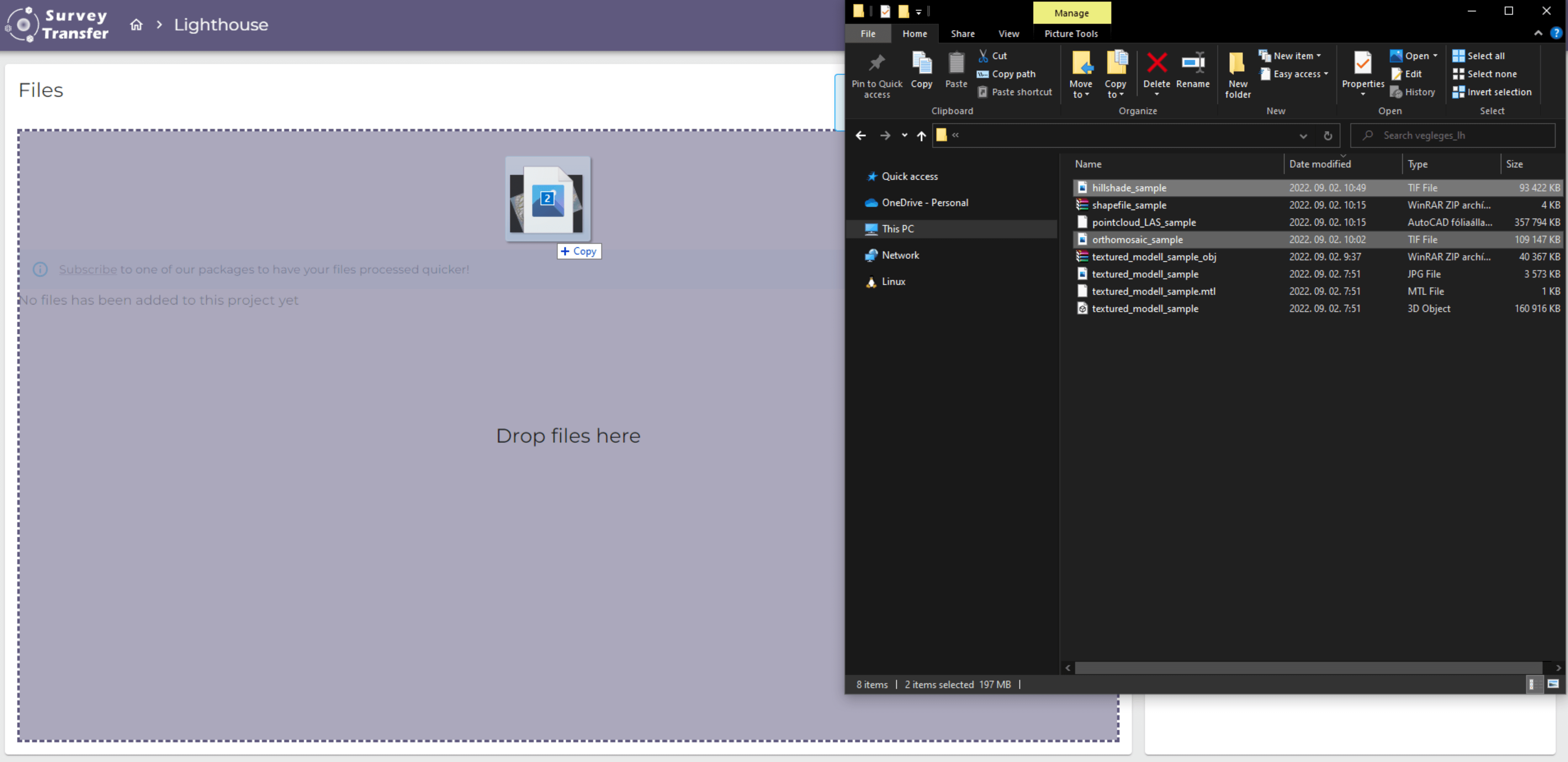
After a geospatial file has been successfully uploaded, SurveyTransfer automatically processes it and converts it to be shareable on the web. On the project page (where the geospatial file was uploaded), a new view can be created, in which a new map or 3D view can be designed!
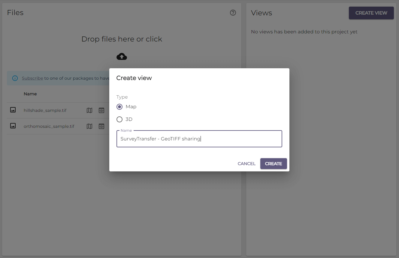
In the map or 3D view the geospatial files can be displayed, saved, and shared.
3. Sharing geospatial data
The project can be shared without creating a view or after creating a map or 3D view. Geospatial data within the project can be shared with business partners with a simple link. Once you’ve created the link, you can immediately copy it and send it to someone. If for some reason you would like to revoke sharing, there is a Revoke Link function.
That’s it! In 3 simple steps you have managed to start your geospatial data sharing journey with us. Easier than you thought right? We are sure that your colleagues and customers will ask for this convenient solution many more times after trying it!
Follow us in our newsletter or on one of our social media platforms (Facebook, Instagram, LinkedIn)!
If you really liked what you read, you can share it with your friends. 🙂
Did you like what you read? Do you want to read similar ones?