
Are you looking for a powerful tool to visualize geospatial data on the web? Look no further than SurveyTransfer geotiff viewer. This cutting-edge software is designed to provide unparalleled geospatial data visualization capabilities. With its user-friendly interface and advanced functionalities, SurveyTransfer geotiff viewer offers a seamless and intuitive experience.
What is a geotiff file?
Geotiff data, or Georeferenced Tagged Image File Format, is a widely-used standard for storing and sharing raster-based geospatial data. It combines the image data with the necessary geographic information, such as coordinate system and map projection, to ensure accurate positioning and scaling of the data.
One of the key advantages of geotiff data is its ability to preserve the spatial and geographic context of the information it contains. Unlike traditional image formats, which treat the data as a simple collection of pixels, geotiffs embed the geospatial metadata directly into the file, allowing for precise georeferencing and integration with other spatial datasets. This makes geotiffs an essential format for a wide range of applications, from remote sensing and cartography to environmental modeling and urban planning.
Geotiff data can encompass a diverse array of geospatial information, including satellite imagery, aerial photography, elevation models, land cover maps, and more. The flexibility of the format allows it to be used across a broad spectrum of industries and disciplines. By leveraging the power of geotiff data, users can gain valuable insights, make informed decisions.
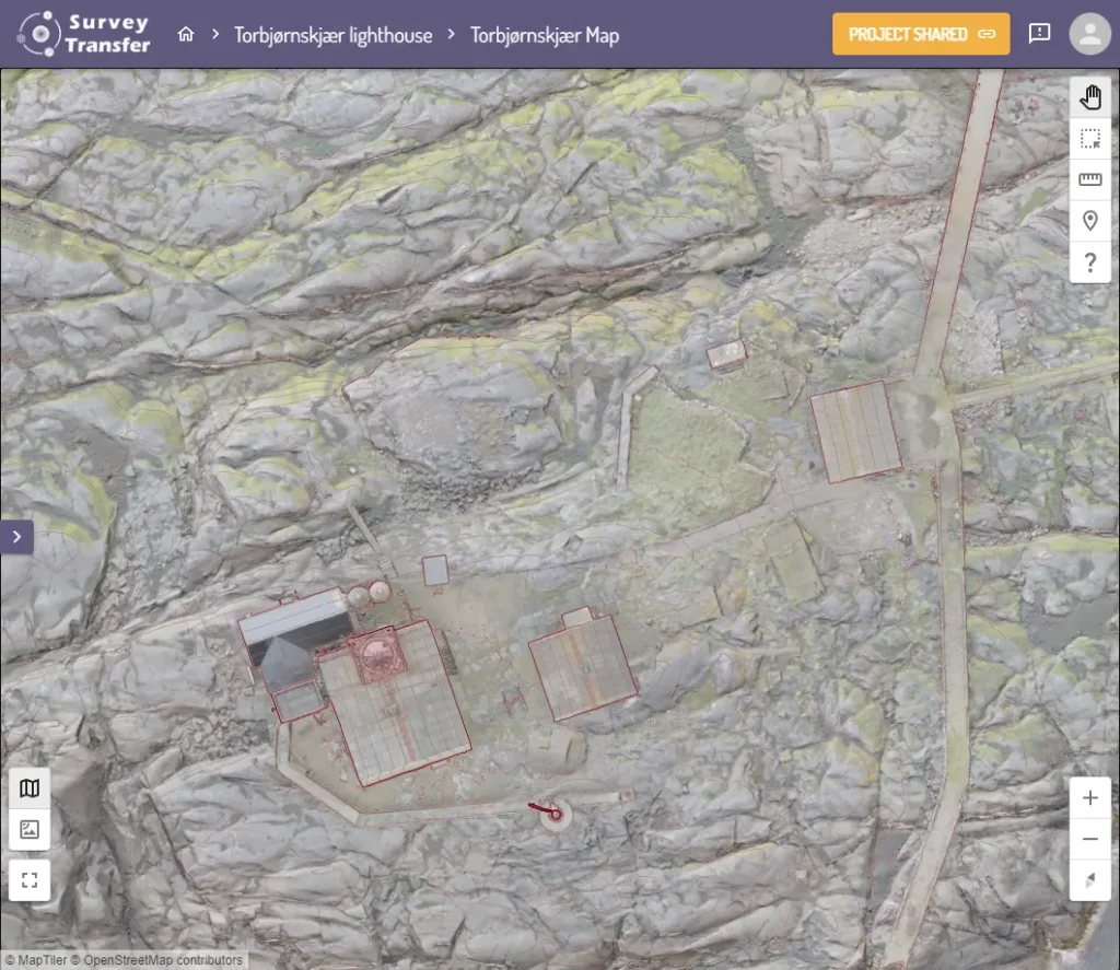
Integrating the geotiff viewer into your workflow
Geospatial data has become an integral part of modern decision-making processes across a wide range of industries, from urban planning and environmental management to disaster response and resource allocation. As the volume and complexity of this data continue to grow, the need for efficient and user-friendly tools to visualize and analyze it has become increasingly crucial. This is where SurveyTransfer’s geotiff viewer comes into play, a powerful and versatile solution that seamlessly integrates into your existing workflow.
One of the key advantages of the SurveyTransfer geotiff viewer is its ability to handle a wide range of geospatial data formats, including the widely-used geotiff format.
Integrating the SurveyTransfer geotiff viewer into your existing workflow is a straightforward process. The tool has an intuitive user interface. For SurveyTransfer’s geotiff viewer, you just need to upload the file and it will be automatically converted into the form that can be displayed on the web.
Key features and capabilities of the geotiff viewer
The SurveyTransfer geotiff viewer is a powerful and feature-rich tool that elevates the visualization of geospatial data to new heights. With its intuitive interface and advanced functionalities, this cutting-edge software empowers users to explore, analyze, and interpret their geospatial datasets with unparalleled ease and efficiency.
One of the standout features of the SurveyTransfer geotiff viewer is its seamless support for a wide range of geotiff data types. Whether you’re working with satellite imagery, elevation models, or land cover maps, the viewer can effortlessly handle and display the data, ensuring that your geospatial information is presented in a clear and visually compelling manner.
Another key capability of the SurveyTransfer geotiff viewer is its advanced visualization tools. Users can leverage overlays, and data layers to customize the display of their geotiff data, allowing them to highlight specific features, identify patterns, and uncover insights that might otherwise be difficult to discern. The viewer’s intuitive solution enhances the user experience, enabling seamless data exploration.
In addition to its core visualization capabilities, the SurveyTransfer geotiff viewer also offers analytical tools. From measuring distance and area, the display provides a comprehensive set of functions. By integrating these analysis capabilities, the SurveyTransfer geotiff viewer becomes an effective decision support tool.
Conclusion: Why SurveyTransfer geotiff viewer is the best choice for geospatial data visualization
As the world becomes increasingly data-driven, the need for robust and user-friendly tools to visualize and analyze geospatial information has never been more pressing. The SurveyTransfer geotiff viewer stands out as the premier choice for geospatial data visualization. It is offering a comprehensive and versatile solution that caters to the diverse needs of professionals, researchers, and enthusiasts.
The SurveyTransfer geotiff viewer can receive extremely large files (up to 50 GB) and display them on the web. The viewer’s analytics capabilities add to its value, allowing users to examine data from multiple perspectives.
In summary, the SurveyTransfer geotiff viewer is one of the best choices for visualizing raster spatial data. It offers versatility, large file uploads, and a user-friendly interface.
If you really liked what you read than you can share it with your friends. 🙂
Did you like what you read? Do you want to read similar ones?