
Agisoft Metashape (formerly Agisoft PhotoScan) is a photogrammetry processing tool. The software is available in Standard and Pro versions. The Metashape Pro version is used to create geospatial content, while the Standard version does not offer geoinformatics functions. This already predicts that the current blog article was created using the Pro version of the Metashape photogrammetry software.
Importing RTK data into Metashape
Less well known is that Agisoft Metashape does NOT read RTK correction data at default settings. You must set up the RTK data scanning before importing the photos in order for the result to appear in the most accurate place in space during the photogrammetry processing,
In the case of a new photogrammetry project, open Metashape and select Tools/Preferences. The Advanced tab of Metashape’s popup window hides the solution for importing RTK data! Within the Export/Import section, you should turn on all XMP metadata scanning functions. To read the RTK data during the photogrammetry processing, the “Load camera location accuracy from XMP meta data” option must be set.
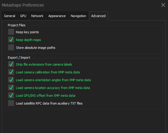
But what is XMP within Metashape and how does it affect photogrammetry processing? The metadata of digital photos is usually stored in the so-called XMP and EXIF formats. Among other things, these metadata formats store position data to be used in photogrammetry processing. XMP is an XML-based format that is structured finer than EXIF. EXIF is more limited in what it can store, but smaller in size because it doesn’t need the separate descriptive data. XMP takes up more space compared to EXIF, but can store any value as it contains the metadata by itself. During the photogrammetry processing, Metashape mainly relies on the XMP metadata to specify the position of the photos and to specify other camera calibration data. It should be emphasized that the scanning of XMP metadata must be done before importing the photos, i.e., before the photogrammetry processing.
Sidenote: If you also want to georeference based on GCPs, in some cases reading the XMP metadata can disrupt the georeferencing and cause incorrect results. If Metashape displays a large spatial error, I recommend turning off XMP metadata scanning.
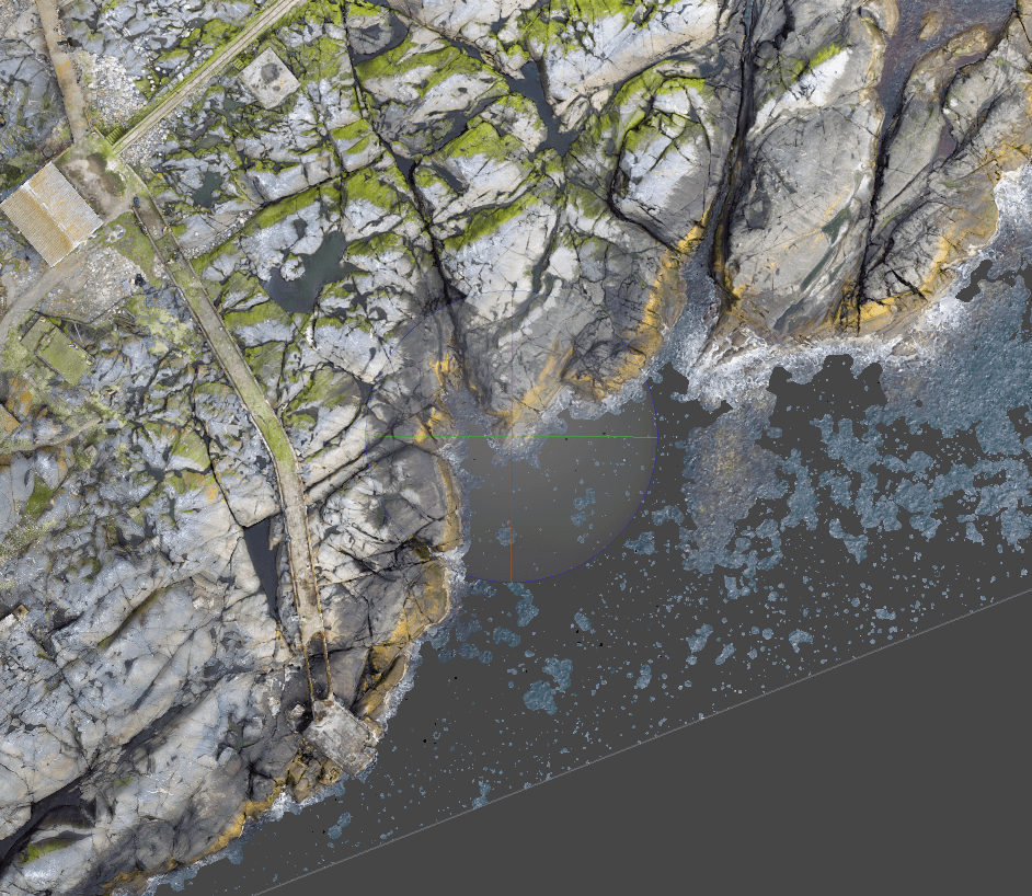
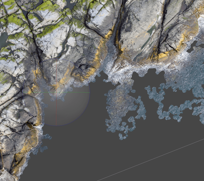
Cutting map and 3D file in Metashape
In Metashape, during some stages of the photogrammetry processing (e.g., sparse point cloud -> dense point cloud -> orthomosaic) it is possible to change the area to be examined (Region). However, few people know that the result of photogrammetry processing can be cut with any polygon!
Polygons in Metashape
In Metashape, it is possible to cut photogrammetry files both with an external file and with a polygon shape drawn in Metashape. An external file can be added to Metashape under the File/Import/Import Shapes menu. Metashape can load shp, kml, kmz, dxf, gpkg, geojson, txt files. In the model space where the results of the photogrammetry processing are displayed, the shape is not displayed if it does not have Z coordinates. It will then appear in Metashape’s “Ortho” window.
Sidenote: If the shape is not displayed in Metashape, check if the “Show Shapes” function is active (![]() ). 2D polygons can also be converted into 3D shapes. To do this, right-click on the shape in the “Ortho” window of Metashape, and then use the “Update Altitudes” function. Metashape’s “Update Altitudes” tool assigns the elevation data of the DEM to the breakpoints of the shape.
). 2D polygons can also be converted into 3D shapes. To do this, right-click on the shape in the “Ortho” window of Metashape, and then use the “Update Altitudes” function. Metashape’s “Update Altitudes” tool assigns the elevation data of the DEM to the breakpoints of the shape.
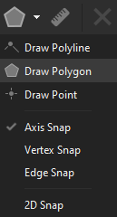
In Metashape, it is possible to draw and snap new shapes to maps and 3D files that are the result of photogrammetry processing. Various snap solutions are also available: to axis, vertex, edge and 2D. For this, the “Draw” window must be opened from the Metashape ribbon, in this case a polygon is required for cutting.
Cutting with shape in Metashape
To cut in Metashape, select the shape that forms the basis for the cut with the left mouse button. After that, the outline of the polygon must be changed to an outer boundary. In the “Ortho”, which displays the photogrammetry results, right-click on the outer line of the polygon, then “Set Boundary Type/Outer boundary”.
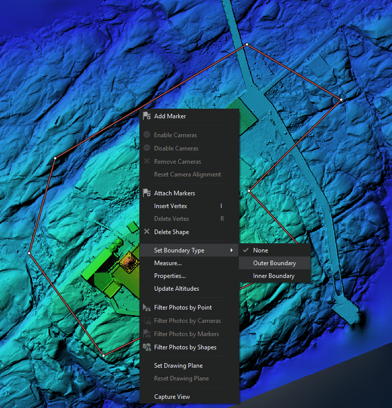
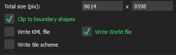
The line delimiting the shape is also visually distinguished by Metashape from other geometries because it appears with a dashed effect. When exporting the photogrammetry result intended for clipping, the Clip to Boundary Shapes check box must be ticked in the dialog window. This can be applied to all photogrammetry result files!
Automatic filtering of individual elements of a 3D model in Metashape
In many cases, smaller separated surfaces are also formed. A good example of this is the following model.
Metashape provides an automated tool for cleaning the “disturbing” spatial parts of the photogrammetry model. The tool can be invoked by clicking Model/Gradual Selection in the menu bar. Here, in the Criterion drop-down menu, you should select “Connected component size”. Metashape automatically analyzes the photogrammetry model and then asks you to enter a value between 0-100%. It is worth setting it to 99%, because this way it only selects the least connected parts.
After that, the selected parts can be easily deleted. A cleaned 3D photogrammetry model can be created with this Metashape process.
Sharing the result of Metashape on the web
Metashape, like most photogrammetry processors, can generate huge files. Displaying and handing them over to clients or colleagues on the web is a serious challenge. SurveyTransfer is a web-based data sharer specialized for this task, which means fast and simple storage, visualization and sharing of large maps and 3D files. It is also a collaboration interface where all participants of the GIS project can work together for success!
For your next drone mapping project, consider the possibilities of SurveyTransfer as a valuable asset for efficient data sharing and a pathway to success. Try SurveyTransfer now for free!
If you really liked what you read, you can share it with your friends. 🙂
Did you like what you read? Do you want to read similar ones?