
In the ever-evolving world of technology, 3D mapping drones have emerged as invaluable tools for a multitude of applications. These unmanned aerial vehicles (UAVs) are equipped with specialized mapping payloads, such as cameras and sensors, which enable them to capture location data and images that can be transformed into intricate maps and detailed 3D models. The advantages they bring to fields like land surveying, infrastructure inspection, and marketing imagery are undeniable.
The output files of a drone survey can be large point clouds, orthomosaics, digital elevation models (DEM) and 3D models. These can be difficult to share with the client and colleagues. It is strongly recommended to use the SurveyTransfer data sharing software! For more information, visit the website of the software manufacturer by clicking HERE.
While multi-rotor drones dominate the field of 3D mapping, it’s worth noting the unique capabilities of fixed-wing drones like Wingtra or Sensefly eBee. Fixed-wing drones, resembling miniature airplanes, offer distinct advantages in terms of extended flight time and enhanced energy efficiency. These traits make them well-suited for large-scale mapping endeavors where covering extensive areas is a priority. However, it’s essential to recognize that fixed-wing drones come with a steeper learning curve in terms of piloting and require more open space for takeoff and landing. In this article, our focus remains on the versatile and easily controlled multi-rotor drones, which are favored for their stability and suitability for various mapping applications.
In this article, we’ll delve into the top 5+1 3D mapping drones that stand out in 2024, each with its unique set of features and capabilities. Whether you’re a professional photographer, surveyor, or simply an enthusiast looking to explore the world from above, these drones offer the perfect blend of functionality and performance.
1. DJI Matrice 350 RTK (Best Drone For 3D Mapping)
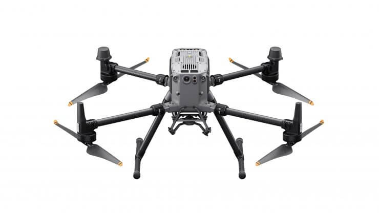
When it comes to mapping missions, the DJI Matrice 350 RTK reigns supreme. This high-end mapping drone boasts an impressive combination of long flight time, extensive range, and robust payload capabilities, making it an ideal choice for professionals seeking top-notch aerial photography and videography experiences. Here’s a closer look at its key attributes:
- Flight Time: Covering vast areas necessitates a lengthy flight time, and the DJI Matrice 350 delivers with up to 55 minutes of flight time, ensuring ample coverage.
- Range: With a remarkable range of up to 8 kilometers, this drone offers the freedom to explore without signal worries, fitting for almost any mapping mission.
- Speed: A top speed of 23 m/s allows for rapid area coverage, while slower speeds cater to long-exposure photography needs.
- Camera: Equipped with a 1080p camera with a 142° field of view.
- Size and Weight: Be prepared for its size and weight, as this drone measures 810×670×430 mm (unfolded, without propellers) and weighs 6.47 kg (with two batteries).
Sidenote: Such an aerial mapping “monster” can be used to produce high-quality maps and 3D files. When sharing data within or outside the organization, it is recommended to use SurveyTransfer! It is the Google Drive of geospatial data!
2. DJI MaVIC 3 ENTERPRISE + RTK (Drone for Photogrammetry and Mapping)
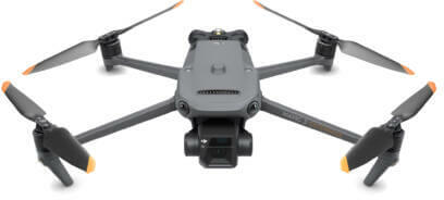
The DJI Mavic 3 Enterprise stands as a pinnacle of drone technology, offering remarkable flight times, extensive range, high speed, and exceptional camera quality. Its features are well worth the investment:
- Flight Time: An impressive 45 minutes of flight time is made possible by a large battery and powerful motors, allowing exploration of larger areas.
- Range: With a range of 8 kilometers, the Mavic 3E empowers you to map expansive regions without worrying about connectivity issues.
- Speed: Boasting a top speed of 15 m/s, this drone allows for swift mapping of vast areas, crucial in time-sensitive scenarios like search and rescue missions.
- Camera Quality: Equipped with a 4/3 CMOS wide camera (effective pixels: 20 MP) and a 1/2-inch CMOS tele camera (effective pixels: 12 MP). It captures high-quality mapping data for various commercial applications.
- Size and Weight: Mavic 3E is 221×96.3×90.3 mm (unfolded, without propellers) and weighs 915g.
3. Autel evo II Pro RTK V3 (Industrial Drone For Mapping)
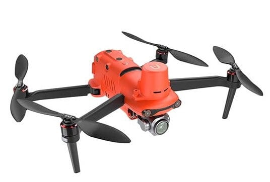
The Autel EVO II combines stability, a high-quality camera, and user-friendliness, making it a solid choice for mapping applications at an affordable price point:
- Flight Time: With a commendable 38 minutes of flight time, the Autel EVO II allows you to cover extensive areas or capture detailed photos and videos.
- Range: 15 kilometer video transmission range.
- Speed: With a top speed of 20 m/s, it strikes a balance between speed and control, making it a suitable choice for mapping missions.
- Camera: The 1″ 6K (20MP) CMOS sensor camera captures high-quality images and videos, ideal for mapping purposes.
- Size and Weight: Measuring 457×558×143 mm (unfolded) and weighing 1237g (with propellers, battery and RTK module), the EVO II strikes a balance between portability and functionality, fitting the role of a solid 3D mapping drone.
4. Autel evo max 4t (Drone For 3D Mapping)
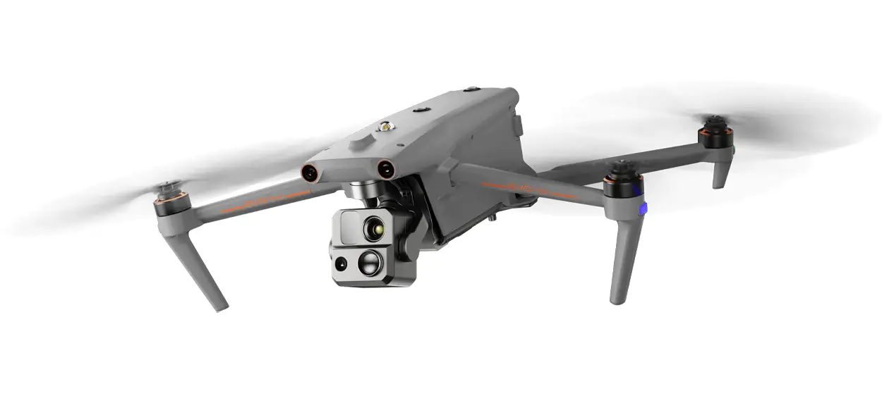
The price of the Autel EVO Max 4T is quite steep, but it is specifically a 3D mapping drone with amazing features:
- Flight Time: A generous 42-minute flight time allows for extended exploration and capturing stunning footage.
- Range: With a range of 20 km, the Autel EVO Max 4T provides an expansive canvas for aerial mapping and photography.
- Speed: Its top speed of 12 m/s ensures swift navigation and efficient coverage.
- Camera: Equipped with a 1/1.28″ CMOS wide camera (effective pixels: 50 MP) and a 1/2″ CMOS tele camera (effective pixels: 48 MP), perfect for high-quality mapping data.
- Size and Weight: Compact and lightweight at 257×136×133 mm (folded, without propeller) and 1600g (with battery and gimbal).
5. DJI Air 2S (Drone For Mapping)
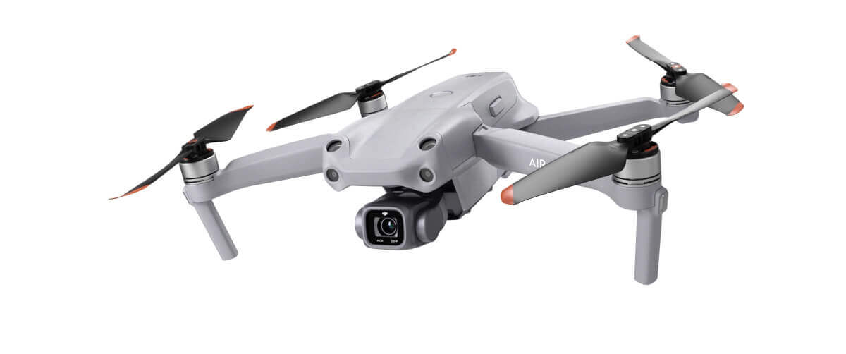
The DJI AIR 2S is a versatile and budget-friendly drone that shines in various scenarios, offering a solid package for everyday use:
- Flight Time: With a flight time of around 30 minutes, it balances duration and battery life well.
- Range: A range of 8 kilometers provides ample coverage for most mapping needs.
- Speed: With a top speed of 19 m/s, it offers a thrilling pace while maintaining control.
- Camera: The AIR 2S’s camera boasts 1″ CMOS 20MP photos, and excellent low-light performance, ensuring high-quality mapping content.
- Size and Weight: Measuring just 183×253×77 mm (unfolded) and weighing 595g, it’s one of the lightest and most portable drones available.
+1 DJI Phantom 4 (the drone legend of 3D Mapping)
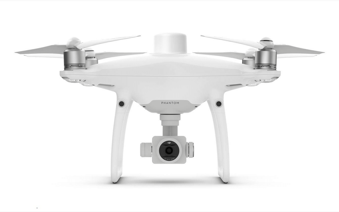
For professionals requiring centimeter-level positional accuracy in their mapping endeavors, the DJI Phantom 4 RTK is the ultimate solution:
- Flight Time: With a flight time of 30 minutes, it caters to most mapping projects without the hassle of frequent battery changes.
- Range: A maximum range of 7 km ensures flexibility in challenging environments.
- Speed: A top speed of 13,88 m/s allows for swift mapping tasks, crucial for larger projects.
- Camera: Equipped with a 1″ CMOS sensor, it captures 20-megapixel images and records 4K video at 60fps, ensuring top-tier mapping content.
- Size and Weight: Compact at 350 mm diagonally and weighing 1391 g, it’s easily transportable and suitable for a range of applications.
Final thoughts on choosing a 3D mapping drone
In conclusion, the world of 3D mapping drones offers a diverse array of options to cater to various needs and budgets. Whether you’re a professional seeking precision or an enthusiast looking to explore the skies, one of these top 3D mapping drones in 2024 is sure to meet your requirements. Explore the world from new heights and unlock the potential of aerial mapping with these remarkable UAVs.
When it comes to aerial mapping or 3D surveying, the files can be extremely large! These can be most efficiently shared with colleagues or business partners using SurveyTransfer software. Try it now for free!
If you really liked what you read, you can share it with your friends. 🙂
Did you like what you read? Do you want to read similar ones?