
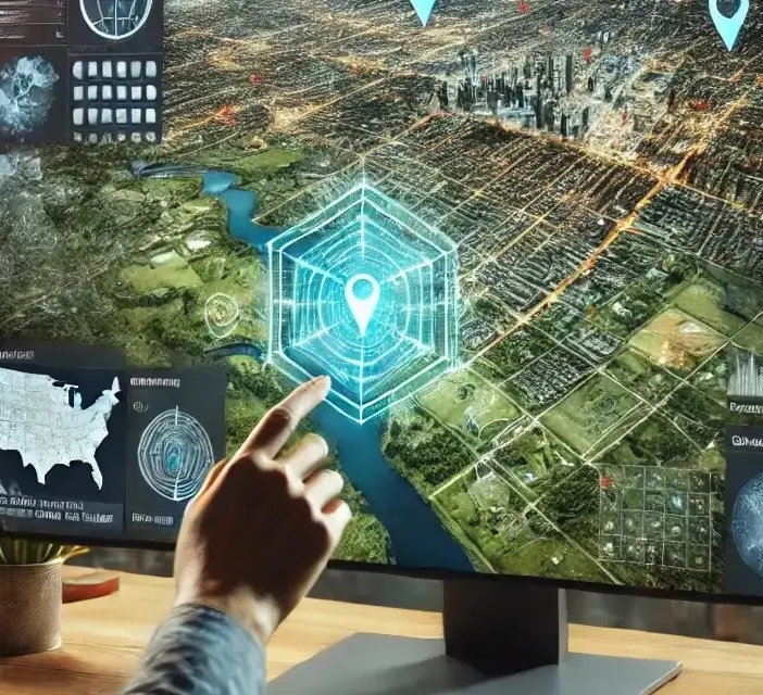
In today’s data-driven world, geospatial applications play a critical role in decision-making across industries. From urban planning to agriculture, geospatial technology helps businesses and governments leverage location-based data for better insights and efficiency. As industries increasingly rely on GIS, remote sensing, and spatial analytics, platforms like SurveyTransfer provide advanced solutions for managing and sharing geospatial data.
This article explores what geospatial applications are, their use cases, benefits, and how SurveyTransfer enhances geospatial data sharing.
What Are Geospatial Applications?
Geospatial applications refer to software and systems that collect, analyze, and visualize spatial data. They utilize technologies like Geographic Information Systems (GIS), remote sensing, GPS, and AI-powered geospatial analysis. These applications enable professionals to interpret real-world patterns, map relationships, and optimize decision-making.
Key Components of Geospatial Applications
- Data Collection: Using satellites, drones, and IoT sensors to gather spatial data.
- Data Processing: GIS software and cloud computing process raw geospatial information.
- Visualization & Analysis: Interactive maps, 3D models, and predictive analytics help users interpret results.
How Do Geospatial Applications Work?
Geospatial applications follow a structured process to analyze and visualize data:
- Data Acquisition – Collecting high-resolution satellite images, drone footage, and LiDAR scans.
- Geospatial Data Processing – Cleaning, organizing, and integrating datasets within GIS software.
- Mapping & Analysis – Applying algorithms to identify patterns, trends, and spatial relationships.
- Visualization & Reporting – Presenting data in interactive dashboards, maps, and 3D models.
- Real-Time Data Sharing – Cloud-based platforms, like SurveyTransfer, allow users to collaborate and share geospatial insights securely.
Key Industries Using Geospatial Applications
1. Urban Planning & Smart Cities
Geospatial technology helps city planners optimize infrastructure, transportation, and resource allocation. Smart city initiatives use geospatial data to enhance public services and sustainability efforts.
3D Digital Twin of a City
View case study: 3D Digital Twin
2. Agriculture & Precision Farming
Farmers rely on geospatial applications to monitor crop health, analyze soil conditions, and optimize irrigation. Precision agriculture reduces waste and increases yield by leveraging real-time satellite imagery and sensor data.
Precision Agriculture
View case study: Precision Agriculture
3. Environmental Monitoring & Climate Change
Scientists use geospatial applications for tracking deforestation, climate shifts, and natural disasters. By analyzing land use and atmospheric changes, policymakers can make informed environmental decisions.
Environmental Condition Assessment
View case study: Environmental Condition Assessment
4. Disaster Response & Risk Management
Emergency responders rely on geospatial mapping to assess disaster zones, predict flood paths, and deploy aid efficiently. GIS-based simulations improve disaster preparedness and response times.
5. Real Estate & Property Development
Real estate professionals use GIS to analyze market trends, assess land suitability, and optimize site selection. Location intelligence helps investors make data-driven property decisions.
6. Telecommunications & Network Planning
Geospatial applications assist in designing and optimizing telecommunications networks. Companies use spatial data to improve signal coverage, identify network gaps, and enhance connectivity.
7. Business & Market Analysis
Retailers and marketers leverage geospatial insights for location-based advertising, customer behavior analysis, and sales territory planning.
8. Powerline Detection & Maintenance
Utilities and energy companies use geospatial technology for monitoring powerlines, identifying faults, and ensuring grid stability.
Powerline Detection
View case study: Powerline Detection
9. Thermal Mapping for Infrastructure
Geospatial applications enable thermal imaging analysis to detect structural weaknesses, heat leaks, and optimize energy efficiency.
Thermal Mapping
View case study: Thermal Mapping
10. Heritage Protection & Conservation
Help document, analyze, and protect historical sites through high-resolution 3D scanning and mapping.
Heritage Protection
View case study: Heritage Protection
Benefits of Geospatial Applications
1. Enhanced Decision-Making
Data-driven insights improve planning and forecasting across industries.
2. Increased Efficiency
Automation of spatial analysis saves time and operational costs.
3. Cost Savings
Optimized resource allocation reduces unnecessary expenditures.
4. Real-Time Data Integration
Live updates from IoT sensors, satellites, and mobile devices improve responsiveness and accuracy.
How SurveyTransfer Enhances Geospatial Data Sharing
SurveyTransfer offers advanced solutions for professionals working with geospatial data:
- Cloud-Based Storage: Securely store and manage large geospatial datasets.
- Collaboration Tools: Share and collaborate on spatial data in real-time.
- Advanced Visualization: Generate interactive 3D models and GIS-integrated maps.
Conclusion: The Future of Geospatial Applications
Geospatial applications are reshaping industries by improving efficiency, sustainability, and decision-making. With advancements in AI, machine learning, and IoT, geospatial technology will continue evolving. SurveyTransfer provides industry-leading tools to help businesses store and share geospatial data effectively.Would you like to explore how SurveyTransfer can transform your geospatial workflows? Visit SurveyTransfer today!
If you really liked what you read than you can share it with your friends. 🙂
Did you like what you read? Do you want to read similar ones?