
We have previously written about the basics of creating QGIS maps. This gives a useful, practical approach, you can read it HERE. In our current article, the emphasis is not on the creation of the map! It will be about exporting, improving and web-based sharing of a pre-made multi-layered map OR a georeferenced map in QGIS.
What is the practical use of sharing a georeferenced image/map through the web? It often happens during a project that a simple paper-based (analog) map or digital image without georeference is available, which contains the basic data required for the project. The survey results of an updated area must often be projected onto this base map. Let’s take a concrete example: the map of an old mine is available, and the area changes of the mining plots must be updated on it. The planned locations of the blastings may also be marked on a separate map. How difficult it is to do all this if the project participants (mining contractor, blasting company, surveying specialist, etc.) start from different maps and are not talking about the same areas. Communication and the organization of the project are greatly improved by a web-based map, on which the updated data is always visible to all project members.
In the next subsection, I will discuss how to export the QGIS map you have compiled in TIF format. If you want to share a georeferenced image in QGIS on the web, skip the next chapter.
Exporting a QGIS map FOR ONLINE SHARING
If you would like to share your own multi-layer (e.g. orthomosaics, contour lines) map on the web, first create the map using the “New Print Layout” in the top menu bar. Our previously linked article will help you in this step.
When your map is ready, click on the Layout/Export as Image… function.
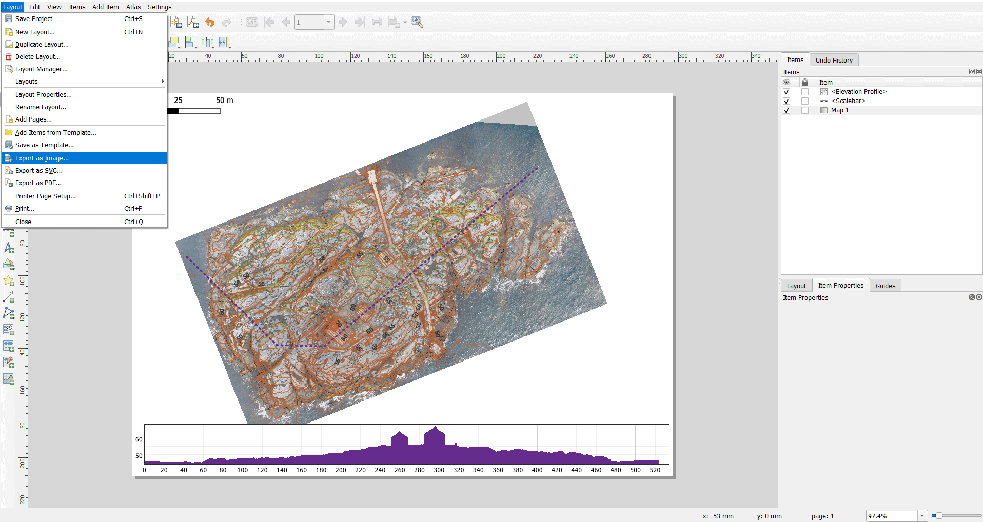
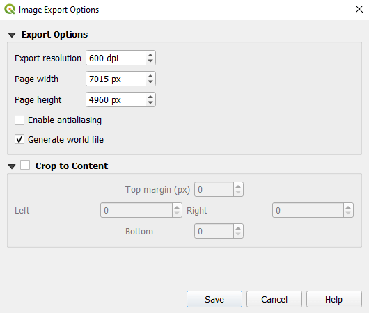
Choose the TIF format, then set the resolution (minimum 300 DPI (= dot per inch)) and ask it to generate a world file.
Exporting a georeferenced MAP
We will not describe the process of georeferencing now, as it is presented in detail in chapter 2.3.1 of our article “5 tips excellent terrain awareness photogrammetry”. When you are done with georeferencing, save the finished file in TIF format.

Conversion of the QGIS map
Unfortunately, the maps produced in the previous chapters still contain incorrect metadata, which not all GIS software can interpret. In the next step, I will show you how to correct them so that you can create a map that can be handled by any GIS program.
First, we create a real GeoTIFF file from the saved image. I don’t know if there is a fake GeoTIFF, but the fact is that what the QGIS Export as Image function gives is unmanageable for many GIS software (e.g. ArcGIS can’t process it either). In QGIS, by right-clicking on the layer of the previously saved image, the shortcut menu appears, where you can select Export/Save As…
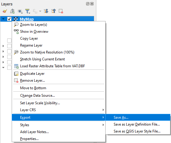
Here, it is important to switch the Output mode to Rendered Image, so that the coloring of the image does not change. Also, you can set a new Coordinate Reference System (CRS) if needed.

Open the exported TIF format map in QGIS, then select the Raster/Conversion/Translate (Convert Format)… menu item.

Here you can specify the value of NoData and the type of output data. The latter two must be set!
The value of NoData shows what value should be substituted for those pixels where no data is stored, but which are part of the TIF raster. Since in our case it is a simple RGB colored image, the colored pixels contain data ranging from 0 to 255. It follows from all of this that it is advisable to enter 256 for the NoData value. I would like to point out that the values of a digital elevation model (DEM) can be completely different, since not the values of the RGB color scale from 0 to 255 are stored in the raster cells, but the height values.
Due to practical considerations for the output data type, I recommend UInt16 (Sixteen bit unsigned integer).
It is a matter of individual preference, but the type of compression can also be set in the drop-down menu next to Profile. This can create GeoTIFF files with smaller file sizes.

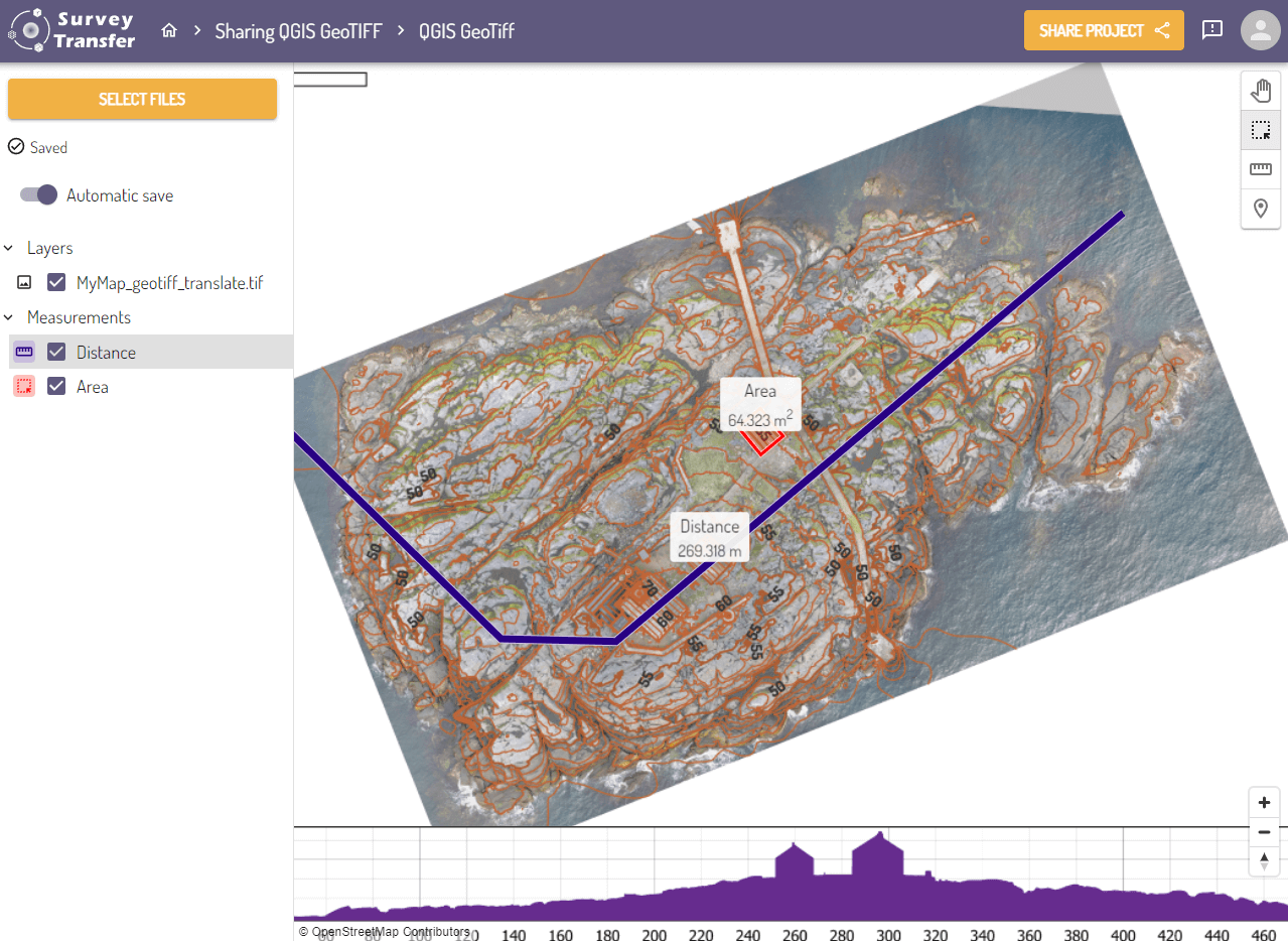
Share a QGIS map on the web with SurveyTransfer
It is recommended to use SurveyTransfer for sharing QGIS map on the web! A project can be created within the application, into which the GeoTIFF file created in the previous steps can be uploaded. Here you can add the uploaded file to a map view and then share it with your customers. Customers and other project participants can work together for success in this collaborative interface.
If you really liked what you read, you can share it with your friends. 🙂
Did you like what you read? Do you want to read similar ones?